
VisionBim – Create Digital Models from Point Clouds
VisionBim is a building digitization software that enables users to create BIM elements like walls, ceilings, floors, windows, and doors directly from point clouds, significantly boosting productivity. It supports the IFC exchange format, ensuring compatibility with BIM design software such as Revit, BricsCad, and ArchiCad. VisionBim enhances efficiency by saving users at least 50% of the usual processing time through quick viewing, AI-driven point cloud classification, and seamless integration with Revit and ArchiCAD.

Architecture, Engineering
AND Construction

MANUFACTURING

HYDRO & UTILITIES

RAILWAYS

TRANSPORTATION

MUNICIPAL
Digitization
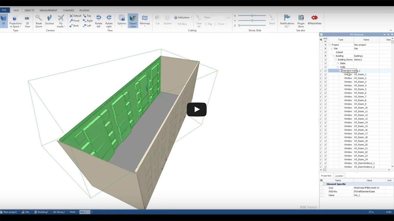
VisionBim the building digitization software allows users to create BIM elements, including walls, ceilings, floors, windows, doors and more, by digitizing directly on point clouds. Duplicate similar levels and activate the pace of your productivity.
Interoperability
VisionBim is compatible with the object-oriented IFC exchange format, a part of the Open BIM standard which is compliant with BIM designs software like Revit, BricsCad, and ArchiCad.
Productivity
VisionBim saves users at least 50% of the usual treatment time and increases productivity through quick viewing, point clouds organisation proposed by our AI classification process, and a connection with REVIT and ArchiCAD.

Request a Custom Quote for VisionBIM – the Point Cloud to BIM software
Are you ready to take your building digitization to the next level with VisionBIM? Take the first step towards boosting your productivity and streamlining your workflow today!
Discover the Power of VisionBim
Transform your point clouds into digital models with ease using our Point Cloud to BIM software – VisionBim
VisionBim the Point Cloud to BIM / Building Digitization Software – Trusted by Governments and Leading Companies
Our software VisionBim has been adopted by a wide range of industry-leading companies and organizations. We are proud to work with such distinguished clients and strive to continually exceed their expectations. Take a look at some of our clients below to see just a few of the companies that trust us to deliver top-quality solutions using our scan to BIM software VisionBim.