Geo-Plus
Geo-Plus · pointcloud

VisionLidar

本番業務のために設計された、デスクトップ点群処理ソフトウェア。

大規模な LiDAR データを、生のスキャンから CAD 対応の成果物まで、ワークステーション上で処理・分類・納品できます。作業量に合ったエディションをお選びください。

AutoCADCivil3DMicroStationBricscadMap3D
VisionLidar interface

Questions about VisionLidar, the free viewer or demos?

Read the FAQ →
LiDAR software for production

LiDAR point cloud processing software for surveyors and engineers

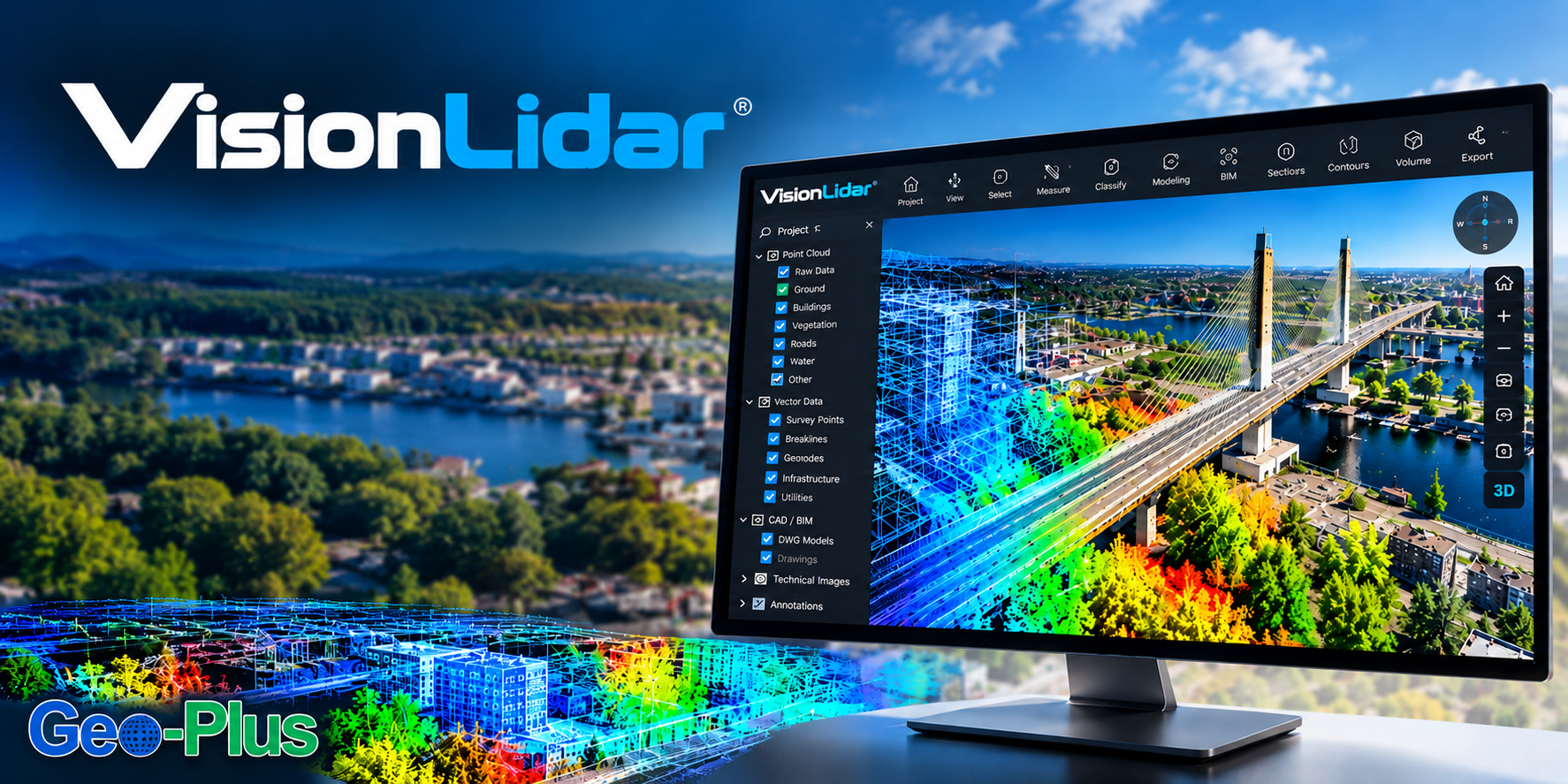
VisionLidar is point cloud software for Windows workstations: import aerial, drone, terrestrial and mobile LiDAR point clouds, process billions of points and deliver CAD-ready results.

LiDAR point cloud

Navigate and measure very large LiDAR point clouds smoothly thanks to tiling, from a single project to a full corridor.

LiDAR processing

Automatic classification of ground, buildings, vegetation and noise, plus batch object detection, to speed up every LiDAR processing step.

Point cloud software

Extract poles, curbs, road markings and power lines, then produce TIN surfaces, contours, profiles, sections and volumes.

LiDAR software for CAD

Send extracted features to AutoCAD, Civil3D, BricsCAD or MicroStation, and share projects with VL365.

Video

VisionLidar 2.0 AI engine — classify billions of points in minutes

More than 10× faster and 10× more GPU-memory efficient than the previous engine.

What’s new in version 2027

VisionLidar · from 36.1.84.16 to 37.0

Interface

A new interface, the same engines

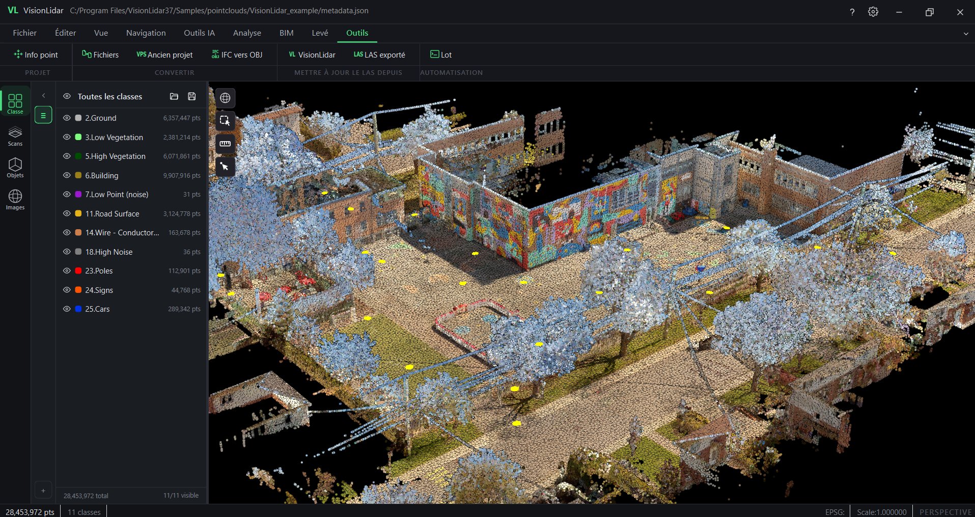
  • Modern application frame

    A native Qt window replaces the previous interface; processing engines are unchanged.

  • Ribbon or compact menu

    Expandable ribbon with contextual toolbars; switch to the compact menu if you prefer.

  • Dockable left panel and toolbar

    Detach, dock and resize; list views for images, utilities (poles, spans, lines), edges, markings, lines and objects.

  • Navigation cube

    Preset views and N / S / E / W axes in the 3D scene; expandable floating tool groups.

VisionLidar 37.0 main window with ribbon

AI

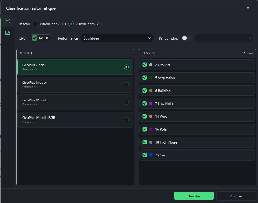
VisionLidar 2.0 AI engine: classification and training

  • One engine everywhere

    The VisionLidar 2.0 (transformer) engine now powers Classify LAS as well as new projects.

  • Classification at project creation

    Run automatic classification while creating the project.

  • Train a new model in one place

    Manual classification, selection and box tools in the training workflow; fence check before export.

  • Class management

    Batch-reassign class numbers to match your exports or models; updated definitions.

  • Your own PLY files

    Use PLY files labelled in other software to train in VisionLidar.

Automatic classification dialog with the VisionLidar 2.0 engine

Input and output

New formats, structured exports and batch processing

  • More ways to create a project

    PLY from any software, RCS (Autodesk ReCap), and E57 + LAZ + RCS combined in one project; FARO SCENE 2026 compatibility.

  • Structured E57 export

    Per-scan grouping, metadata and point attributes preserved on export; faster LAZ updates.

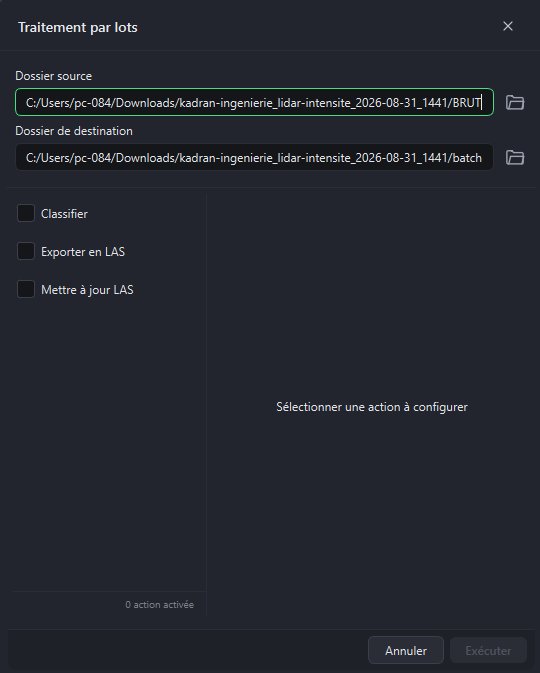
  • Batch processing

    Run classification, catenary or road-marking detection on entire folders.

Batch processing dialog

Also new

Also new in VisionLidar

  • Utility analysis reports

    Pole tilt, line clearance and collision reports exported to CSV, PDF and GeoJSON; pole radius shown as a cylinder.

  • Scan to Mesh and Refined Mesh

    Meshing tools, renamed and refreshed.

  • Volume calculation

    Improved volume calculation workflow.

  • Two-click quick section

    Analysis › Sections: two clicks and the section is created.

  • Grouped registration tools

    Point-to-point, list-based, origin change and reindexing grouped under Tools.

  • Spherical images

    Choose the image folder manually if automatic detection fails; rotate from the toolbar; simpler deletion.

  • Image-only projects for VL365

    Publish a spherical-image project to VL365 without a point cloud.

  • Detections at a glance

    Lists of utilities, edges, road markings and lines in the left panel; one click to locate them in the scene.

Turn your point clouds into actionable results

From processing billions of points to producing professional deliverables, VisionLidar speeds up every step of your LiDAR workflow.

Several billion
points per project
128 classes
to segment your data
4 LiDAR sources
airborne, drone, terrestrial and mobile

The 5 benefits that make the difference

01

Handle very large-scale projects

Manage several billion points smoothly thanks to tiling, whether your data comes from an airborne, terrestrial or mobile survey.

02

Automate classification and detection

Speed up processing with ground, building, vegetation and noise classification algorithms, plus batch object detection.

03

Survey directly inside the point cloud

Measure, vectorize and extract poles, curbs, road markings and power lines, then store them as points or polylines.

04

Produce professional deliverables

Create TIN surfaces, contours, profiles, cross-sections, alignments and volume calculations in one integrated workspace.

05

Connect LiDAR to your ecosystem

Send extracted features to AutoCAD, BricsCAD or MicroStation, then archive, publish and share your projects with VisionLidar365.

Billions of points.
Faster decisions.
Request a demo
対象ユーザー

測量会社、LiDAR サービス事業者、交通・インフラ分野のエンジニア。

数十億点をスムーズに

ストリーミング処理エンジンにより、一般的なワークステーションでも大規模スキャンを快適に操作できます。

自動分類

地表、植生、建物、送電線を数分で分類します。

CAD へのネイティブ出力

AutoCAD、Civil3D、MicroStation、Bricscad へ直接出力します。

地物抽出

点群から横断図、ブレークライン、縁石、DTM を抽出します。

エディションを選択

VisionLidar

VisionLidar Standard

小規模チームや単独プロジェクト向けのエントリー処理。

  • 最大 10 億点の点群を表示・操作
  • 基本的な手動・半自動分類ツール
  • AutoCAD、Bricscad、MicroStation への標準出力
  • 営業時間内のメールサポート
VisionLidar Standard の見積もりを依頼
人気
VisionLidar Premium

制作チーム向けのプロフェッショナルな自動化。

  • Standard の全機能に加え、点群サイズ無制限
  • 地表、植生、建物、送電線の自動分類
  • 地物抽出:ブレークライン、横断図、縁石、DTM
  • 優先サポートとソフトウェア保守
VisionLidar Premium の見積もりを依頼
VisionLidar Ultimate

大量データと複数ユーザーのワークフローに対応するエンタープライズ機能。

  • Premium の全機能に加え、バッチ処理の自動化
  • 分類用のカスタム AI モデルと学習パイプライン
  • 複数ユーザーでのプロジェクト共有とバージョン管理
  • 専任のアカウントマネージャーと導入支援
VisionLidar Ultimate の見積もりを依頼
導入事例

"CIMA+ が VL365 で点群データ容量を 75% 削減"

40 TB の構造化スキャンを VL365 上の 10 TB の統合 LAZ に。精度、密度、360° ビューはそのままに、スキャン位置ごとの課金やフォーマットへの依存もありません。

ほかの導入事例を読む →
専門家に相談

VisionLidar のデモを依頼

プロジェクトについてお聞かせください。1 営業日以内に上級スペシャリストがご連絡します。

送信により、Geo-Plus がお問い合わせについてご連絡することに同意したものとみなされます。お客様のデータを第三者と共有することはありません。

VisionLidar の実際の動きをご覧になりませんか?

ワークフローに合わせたライブデモをご予約ください。