
Exploring the Power and Potential of LiDAR
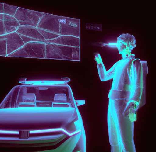
To explore the power and potential of LiDAR, it is important to first understand what LiDAR is. LiDAR, or Light Detection and Ranging, is a remote sensing technology that uses lasers to measure the distance to objects and surfaces. By emitting a laser beam and measuring the time it takes for the beam to bounce back after hitting an object, LiDAR can therefore create a detailed 3D map of the surrounding environment.
LiDAR has a wide range of applications in various fields, including mapping, surveying, and self-driving cars. Some of the key uses of LiDAR technology include:
- Mapping: LiDAR can create high-resolution, accurate maps of landscapes and terrain. It is particularly useful for mapping areas that are difficult to access or where traditional surveying methods are not feasible.
- Surveying: LiDAR can measure the distance to objects and surfaces. LiDAR it a useful tool for surveying land, buildings, and infrastructure.
- Environmental monitoring: LiDAR can monitor and measure the height and density of vegetation. It also helps to track changes in the environment over time.
- Engineering and construction: LiDAR can measure the dimensions and shape of structures. This feature makes LiDAR a useful tool for engineering and construction projects.
In summary on the Power and Potential of LiDAR
LiDAR technology has become an essential tool in a wide range of fields. LiDAR has the ability to accurately and efficiently measure and map the environment. As the technology continues to evolve and improve, it is likely to have an even greater impact on industries and sectors around the world.
Apart from the hardware components, software is also a critical part of LiDAR systems. One such software solution that is worth highlighting is VisionLidar.
VisionLidar is a software that enables users to process and analyze LiDAR data. It offers a range of features and tools that make it easy to visualize, analyze, and interpret LiDAR data.
One of the key benefits of VisionLidar is its ability to handle large amounts of data quickly and efficiently.
Moreover, VisionLidar provides advanced features for data analysis and interpretation, including support for advanced visualization techniques, such as 3D rendering and point cloud rendering, as well as tools for data filtering, clustering, and classification.
Overall, VisionLidar is a powerful and intuitive software platform that makes it easy for users to process and analyze LiDAR data. Moreover, Its processing capabilities and advanced data analysis tools make it a valuable asset for any organization that relies on LiDAR technology.
If you are a Geo-Plus customer and would like to visit your online portal you can always click here