
WEB POINT CLOUD SHARING PLATFORM

Architecture, Engineering
AND Construction

MANUFACTURING

HYDRO & UTILITIES
RAILWAYS
TRANSPORTATION

MUNICIPAL
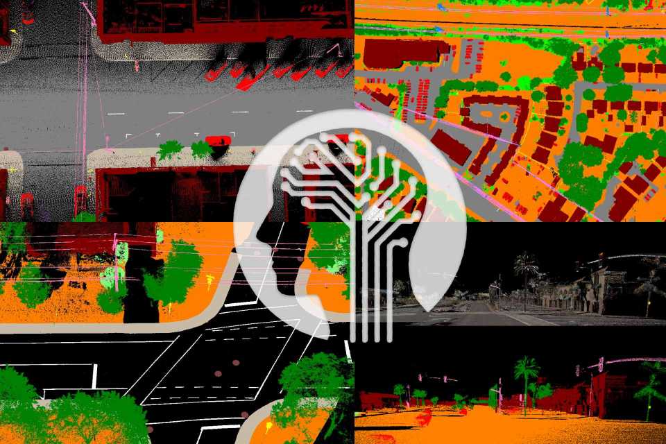
LiDAR Software VisionLidar365 Features
Watch the videos below to learn more on our LiDAR software features!
- On-Premises or SAAS web solution to share and create deliveries with your points cloud projects.
- Secured platform with flexibility, granularity and ease to configure .
- Responsive Web Design which allows accessing your data anywhere, anytime, with any platform.
- Organize your data by map location and thematics.
- Get periodic usage statistics.
- Map Wizard to easily and quickly publish your data.
- Organize and publish your Land, Mobile or Airborne Lidar project in one unique platform.
- Connect with an external Geo server and plot your digital maps by using WFS, WMS, WMTS, BING, Google MAP or Open Street Map.
- Asset inventory & vectorisation capabilities for points elements, line segments and polygons.
- Full 3D immersive environment.
- Customizable workspace with synchronized views.
- Panoramic view for spherical images including point cloud or numeric model in overlay.
- Import your 3D models and create mockups of your planning.
- Annotation tool with attached document possibility to build your POI.
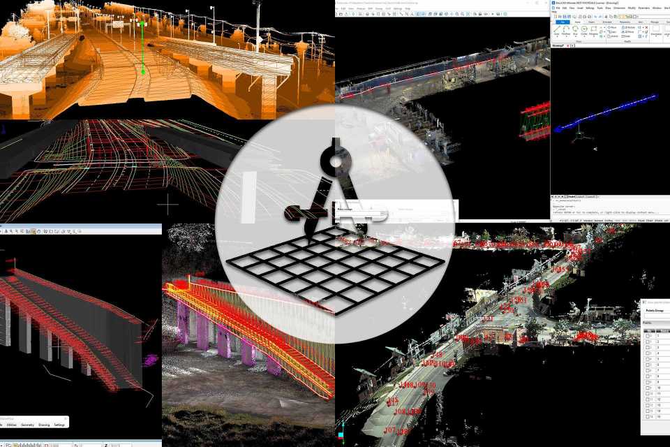
- Create Sections and Profiles for better longitudinal or cross sections analysis on corridors.
- Virtual Reality Ready and immerse yourself with a full 3D environment.
- Make precise measurements from point to point or from point to 3D models.
The LiDAR Software you can use in multiple industries!
POWER AND UTILITY
- Locate, vectorize or update your electricity or utilities facilities inventory from the comfort of your office.
- Visualize and analyse your asset condition in its own environment like you were there.
- Get a precise interpretation by using spherical images that bring you directly on site.
- Validate phase distribution and equipment installed.
- Create a digital twin from planned line distribution to as built on site reality.
ASSET INVENTORY
- Get the position of your assets and qualify them with different attributes.
- Make online measurements where and when needed .
- Collaborate with different people in your community .
- Create POI of your main assets and attach extra information such as pdf, videos, docx etc…
- Export or import assets collected for or from CADs and GIS.
- Organize your asset collection by colorized layers.
BUILDING MANAGEMENT
- Create your building footprint for Exterior Interior.
- Easy inventory with comments and PDF attachment file over point cloud and 3d image.
- Easy intuitive interface with tools tips.
- Manage your storey view using our horizontal clippings.
- Make precise measurements from point to point or from point to 3D models.
- Floor flatness analysis.
- Get a precise view of your areas by using the spherical images.
MANAGE
BROADCAST
EXPLORE
EXPLOIT
MANAGE
Publication of data on maps, user access, usage statistics, data life cycle, customized work environment.

BROADCAST
Prepare, preview and upload your Lidar and imagery data to the CLOUD (.las/.laz, *.e57, *.fls, *.lsproj, *.fws, *.pts, *.csv, *.rcp) using the VL365 creation tool.

EXPLORE
Virtual tour of your 3D environments organized in layers of information. Navigation mode ORBIT, EARTH, FIRST PERSON, Share your data with collaborators via the web portal or simply from an executable file in local mode. Virtual reality support Spotting in a 3D environment with the help of a 2D cartography.
EXPLOIT
Leverage your data with powerful collaborative tools for annotation, measurement, clipping, profile creation, 3D model and vectorization.
VisionLidar 365 Brochure – Home to our LiDAR Software Features in details!
Here, you can find detailed information about the features and benefits of our advanced web-based point cloud sharing platform.
With VL365, you can easily publish, share, and collaborate on 3D data from points clouds and 360 imagery on multiple devices. From simple and powerful measurement tools to vector data digitization, VisionLidar 365 has a wide range of features to help you leverage your data and improve your productivity.
